Maps
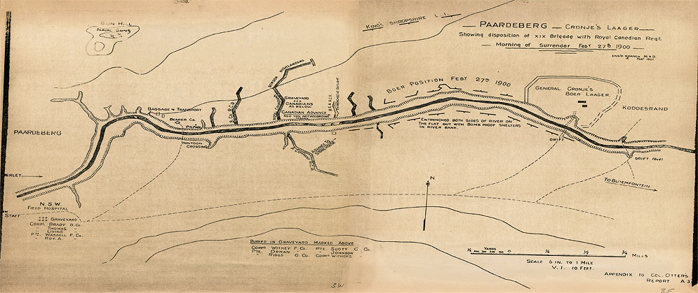
Map of the Battle of Paardeberg Showing the Area of General Pieter Arnoldus Cronje's Laager and the Position of the XIX Brigade Including the Royal Canadian Regiment on the Morning of 27 February 1900 when General Cronje's forces surrendered
Click to view: [Large 1550 X 652] (214Kb)